- Region
- Águilas
- Alhama de Murcia
- Jumilla
- Lorca
- Los Alcázares
- Mazarrón
- San Javier
-
ALL AREAS & TOWNS
- AREAS
- SOUTH WEST
- MAR MENOR
- MURCIA CITY & CENTRAL
- NORTH & NORTH WEST
- TOWNS
- Abanilla
- Abarán
- Aguilas
- Alamillo
- Alcantarilla
- Aledo
- Alhama de Murcia
- Archena
- Balsicas
- Blanca
- Bolnuevo
- Bullas
- Cañadas del Romero
- Cabo de Palos
- Calasparra
- Camping Bolnuevo
- Campo De Ricote
- Camposol
- Canada De La Lena
- Caravaca de la Cruz
- Cartagena
- Cehegin
- Ceuti
- Cieza
- Condado de Alhama
- Corvera
- Costa Cálida
- Cuevas De Almanzora
- Cuevas de Reyllo
- El Carmoli
- El Mojon
- El Molino (Puerto Lumbreras)
- El Pareton / Cantareros
- El Raso
- El Valle Golf Resort
- Fortuna
- Fuente Alamo
- Hacienda del Alamo Golf Resort
- Hacienda Riquelme Golf Resort
- Isla Plana
- Islas Menores & Mar de Cristal
- Jumilla
- La Azohia
- La Charca
- La Manga Club
- La Manga del Mar Menor
- La Pinilla
- La Puebla
- La Torre
- La Torre Golf Resort
- La Unión
- Las Palas
- Las Ramblas
- Las Ramblas Golf
- Las Torres de Cotillas
- Leiva
- Librilla
- Lo Pagan
- Lo Santiago
- Lorca
- Lorquí
- Los Alcázares
- Los Balcones
- Los Belones
- Los Canovas
- Los Nietos
- Los Perez (Tallante)
- Los Urrutias
- Los Ventorrillos
- Mar De Cristal
- Mar Menor
- Mar Menor Golf Resort
- Mazarrón
- Mazarrón Country Club
- Molina de Segura
- Moratalla
- Mula
- Murcia City
- Murcia Property
- Pareton
- Peraleja Golf Resort
- Perin
- Pilar de la Horadada
- Pinar de Campoverde
- Pinoso
- Playa Honda
- Playa Honda / Playa Paraíso
- Pliego
- Portmán
- Pozo Estrecho
- Puerto de Mazarrón
- Puerto Lumbreras
- Puntas De Calnegre
- Region of Murcia
- Ricote
- Roda Golf Resort
- Roldan
- Roldan and Lo Ferro
- San Javier
- San Pedro del Pinatar
- Santiago de la Ribera
- Sierra Espuña
- Sucina
- Tallante
- Terrazas de la Torre Golf Resort
- Torre Pacheco
- Totana
- What's On Weekly Bulletin
- Yecla


- EDITIONS:
 Spanish News Today
 Alicante Today
 Andalucia Today
Sierra Espuña walking routes, the PR-MU 65 from La Santa in Totana to Aledo
A 2.6-kilometre walk in the picturesque foothills of Sierra Espuña
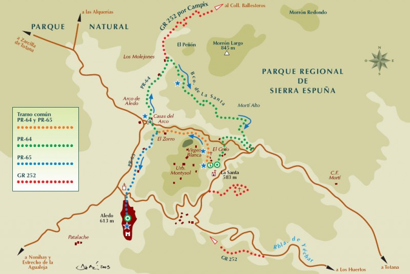
 This walk in the south-western foothills of Sierra Espuña follows an easy 2.6-kilometre route, starting at the Sanctuary of Santa Eulalia in the La Sierra district outside the town of Totana and taking walkers and cyclists to the hilltop town of Aledo. The walk usually takes approximately an hour on foot, but is linear, so those parking in La Santa will need to either return on foot or arrange alternative transport.
It includes only 30 metres of climbs and descents, and the first part is shared with the circular PR-MU 64 route which takes walkers on a longer route back to La Santa.
Signposting along most of the route is in white and yellow paint, although the first stretch to Los Molejones is also part of the much longer GR-252 path, which is signposted in white and red.
The route
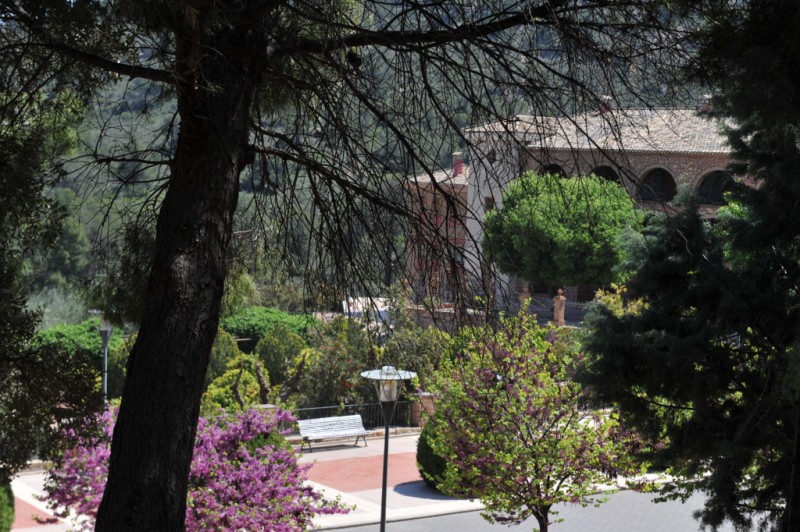
The PR-MU 65 route begins at the sanctuary and church of Santa Eulalia on a tarmacked surface and then leads up and to the left on an unsurfaced track, past some country properties.To find the path, walk out of the main doorway of the sanctuary with the car park behind, and then climb some steps located at the left-hand side of the gardens, and up through the top level of the gardens, past a water feature and onto an unsurfaced track, continuing past several rural rental properties.

Zig-zagging up the slope, it reaches the Virgen Blanca viewing point after 380 metres, where there is a drinking water fountain. From here head further up to the electricity pylon, ignoring a small path which heads down to the right.
The path soon begins to head downhill again, at which point look out for a small path which leads through the pine trees to the left (distance 0.64 kilometres).
Walkers can enjoy the views as they emerge from the pine grove at the Casa del Pocico and then pass an old olive tree. The path then heads diagonally up to the right to a group of almond trees (distance 1.11 km) and then further right to the Casa de El Zorro: here, take the right turn at the junction.
It is at the next junction that there is the option of heading right on the PR 64, but the PR 65 goes left towards Aledo, which is already in view at this point. Keep to the main marked path, which continues down through Las Zanjas, flanked by houses and almond trees. At the last junction (distance 1.9 km) continue down to the left, following the fence which runs around a plot of land, until emerging onto the tarmac and continuing straight on.
Pass the cemetery of Aledo and rejoin the MU-502 to reach the town: take care, as the road can be quite busy at this point. Head straight on through the Plaza de la Diputación to reach the old town centre of Aledo, where the castle looks out from its promontory over the foothills of Sierra Espuña and the Guadalentín valley beyond.

Click for further information about the municipality of Totana.
Click for more information about the Sierra Espuña.


